Building date: Demolished about 2010?
Original use:
Corner structures:
Mortar application and content:
Types and uses of stones:
Types and choice of windows:
Structures with similar masonry details:
Masons who worked on building:
Unique features:
Map views courtesy Google Maps
Town of Greece and Monroe County Maps
Structure not included in Roudabush Survey or Schmidt books. Name and address information in the title provided by hand written note in Roudabush Survey document, source unknown. Assuming that the address is correct, Google Maps shows a new residence structure at this address, suggesting that the cobblestone structure was demolished.
"The Cobblestone Houses of Upstate New York", compiled by Dorothy Wells Pease 1941. Research done in collaboration with Hazed B. Jeffery, supplemented with material furnished by Carl F. Schmidt. Reference the eighth paragraph on page 2.
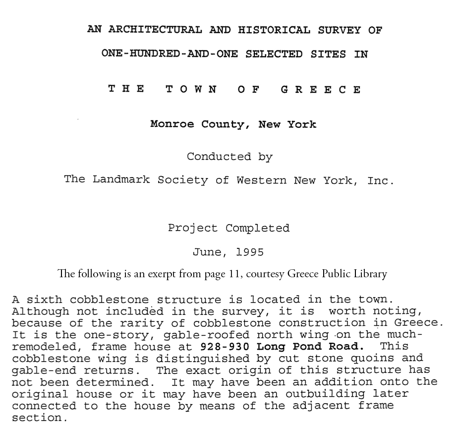
Cover page and page 11 excerpt composited to conserve space.
Back in 2011 I tried to track this one down. I drove by this location and the site was uncared for and there was no cobblestone structure on it. I tried tracing through old maps, names of earlier owners—but no luck. I noted in my files:
MILK HOUSE
Dist 9, Lot 14, 1924 Map (Plate 32) "Frank Herman, 21a"
1872: no structure shown
East side Long Pong Rd ~ opposite Mill Rd
Greece (262800) 059.03-2-50.11
Dorothy Wells Pease wrote: "There is a low ell or milk house on a farm on Long Pond Road near Mill Road."
Although not on Roudabush's list, a hand-written note is scribbled in the margin at the Landmark Society: "4 - North Wing, 928-930 Long Pond (possibly smokehouse, now attached to house)". On 27APR2011 this structure was gone and it was a completely vacant lot. Not documented by CFS.
This is Dorothy Wells Pease's 8th entry on pg 2. This does show on DWP's accompanying map as a half circle; so it's probably an authentic siting. She did this inventory in the early '40s and her work is exceedingly reliable. If she calls it a "milk house" and denotes a half-circle, I would take her at her word. I also note that because the 1872 map doesn't show a structure, my guess is that the "milk house" that DWP saw had long been an orphaned remnant on the site.
04/25/2026 Karen Crandall email.

|
